


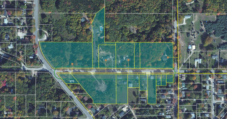
LandVision
About LandVision
LandVision Pricing
Contact LandVision for pricing information.
Starting price:
$8,400.00 per year
Free trial:
Available
Free version:
Not Available
Other Top Recommended Facility Management Software


Most Helpful Reviews for LandVision
1 - 9 of 9 Reviews
Logan
Verified reviewer
Real Estate, 5,001-10,000 employees
Used daily for more than 2 years
OVERALL RATING:
5
EASE OF USE
4
FUNCTIONALITY
5
Reviewed May 2019
Helpful For My Business
The amount of property information available.
CONSHow they only upload it every quarter to half a year.
Eddie
Real Estate, 1 employee
Used weekly for more than 2 years
OVERALL RATING:
5
EASE OF USE
5
VALUE FOR MONEY
5
CUSTOMER SUPPORT
5
FUNCTIONALITY
5
Reviewed October 2019
Customer Support
I signed up for the Digital Map LandVision software in 2005 to help my company cover a large number of counties in Florida. Our primary business was selling land and developed lots to National and strong regional homebuilders. During our first four months we earned over $600,000 in commissions. Since then it has been our main tool for gathering product information, comparable and producing visual maps that help put everything into perspective for the potential purchaser. Over the years Digital Map has worked hard to continue to improve their product. They provided educational tools that helped us learn how to get the most value out of the software. Their Support Staff was always there if we had a problem. There is no doubt that LandVision has been one of my best investments ever.
PROSI am a commercial land broker in Florida. I have used this product since 2004-5. It has everything with all of the tools that I need to locate, Identify, apply layers that are applicable such as the "wetlands" to provide my clients with the most up to date information. Also, Yesterday I accidently deleted almost all of my data that I had put on my LandVision map. My bad…just pushed the wrong button. I called your Support staff and I got rep on my call. Obviously I was very upset, but she said that she could help me out and she remained calm and reassuring. She went through a few things once she got control of my screen and said that she had to talk to someone in “Technical Support”. When she came back on the call she had me open up the program again and all of work was back up.
CONSWhen I try to measure an area the background aerial turns "blue" and won't go back to being an aerial until I close the polygon.
Reason for choosing LandVision
N/A
Stephen
Real Estate, 51-200 employees
Used daily for less than 2 years
OVERALL RATING:
1
EASE OF USE
1
VALUE FOR MONEY
1
CUSTOMER SUPPORT
1
FUNCTIONALITY
1
Reviewed September 2022
Good Idea...Terrible Product
Terrible. Despite this product being a SAS subscription, they still require 60 day notice to cancel. I attempted to cancel 45 days prior to our term ending and they denied this request saying I waited to long. I understand this with Hotels, Product and supplies, but for something that is a service it is ridiculous.
PROSIt has good data in theory and provides relevant information. In practice the application is difficult to use and common tasks take 4 to 5 steps where every other similar software takes one or two. Really just a pathetic user interface.
CONSEverything. Not user friendly, data is extremely old in my market, terrible time trying to upload and organize our own data.
Alisha
Real Estate, 201-500 employees
Used daily for more than 2 years
OVERALL RATING:
5
EASE OF USE
4
CUSTOMER SUPPORT
4
FUNCTIONALITY
4
Reviewed March 2021
Great Real Estate Research Tool
I love LandVision it's particularly good at allowing me to know the shape of a parcel, without having to dig through multiple municipalies GIS Maps. Smaller cities have old systems that aren't very user friendly.
PROSLandVision is such a great tool. It allows me to see the actual shape of parcels of land and the parcel ID numbers are always correct. They also have this drawing feature that comes in handy for quick drawing jobs, versus going into Photoshop or InDesign.
CONSOwner information is only updated when the local municipality updates it, which can be once a year, but I've found data that hasn't been updated in years.
Ford
Used daily for more than 2 years
OVERALL RATING:
5
EASE OF USE
4
CUSTOMER SUPPORT
5
FUNCTIONALITY
5
Reviewed January 2018
Good, nneeds to be intuitive to make heat maps and not make it lag so much when we have many layers.
quick measure of property lines.
PROSDon't need to install anything. I like being able to pull info from the map without having to log into a different database.
CONSCan't rotate the map. I hate that you can't right click to open in Google Street View. I hate that it I have to do so many things to make a heat map. It should be easier to do.
Scott
Used weekly for more than 2 years
OVERALL RATING:
4
EASE OF USE
4
VALUE FOR MONEY
5
CUSTOMER SUPPORT
5
FUNCTIONALITY
5
Reviewed February 2018
We use LandVision in our firm for quick access to ownership and aerial imagery.
LandVision is our go-to resource for real estate ownership, mapping and aerials. It provides a quick and precise platform giving us the ability to respond to client requests in a timely, efficient manner. The many dynamic uses of the software are also a plus. Whether for basic or advanced purposes, it allows us to customize our workspaces to depict many facets of geographical information.
CONSReally the only con I have with the site is the dpi quality of print and PDF imagery. This could be an area of improvement in the future. The system runs off of the Bing Maps platform which helps with the speed of the product but limits the quality of the images.
Samuel
Used daily for less than 12 months
OVERALL RATING:
3
EASE OF USE
4
VALUE FOR MONEY
4
CUSTOMER SUPPORT
3
FUNCTIONALITY
4
Reviewed June 2018
Very useful tool.
Reliable software that is a great launching pad for more in depth property research. I can easily find information.
CONSOld maps, needs updating. I find myself having to use both Google Maps and this software to look up properties because maps are so old. Also, would be great to have a streamlined app that goes with the PC version.
Anne
Used less than 2 years
OVERALL RATING:
4
EASE OF USE
3
CUSTOMER SUPPORT
4
FUNCTIONALITY
4
Reviewed June 2018
The customer support is great. The software has a lot of great features.
Lots of great features. It would be great if a representative could come and conduct a LUNCH AND LEARN with our Brokers. I'm sure more of our staff would use the tool and its many uses.
CONSIt Can be a little fickle... One really needs to learn how to maneuver through the software I don't always use the software on a regular basis.
Gabrielle
Research, 501-1,000 employees
Used less than 6 months
OVERALL RATING:
3
EASE OF USE
3
VALUE FOR MONEY
2
CUSTOMER SUPPORT
3
FUNCTIONALITY
3
Reviewed March 2019
A tool for realtors
Its average. It will assist realtors but is limiting in the information and data display.
PROSI used this software for some aerial imagery. Once I had it up and running, I got to explore it a bit and see that it does have some capabilities and data that is useful - but specifically for those dealing with human geography. You are able to look up ownership, property boundaries and in aerial imagery. This is ideal for realtors, who only really need this information, however, better spatial analyses can be done using GIS software if need be.
CONSIts tedious and the data is dated. It crashed on me once. Map navigation is restricted. There is free software that can do a lot more and so this would not be my first choice.