


Geospatial Analytics
No reviews yet
Overview
About Geospatial Analytics
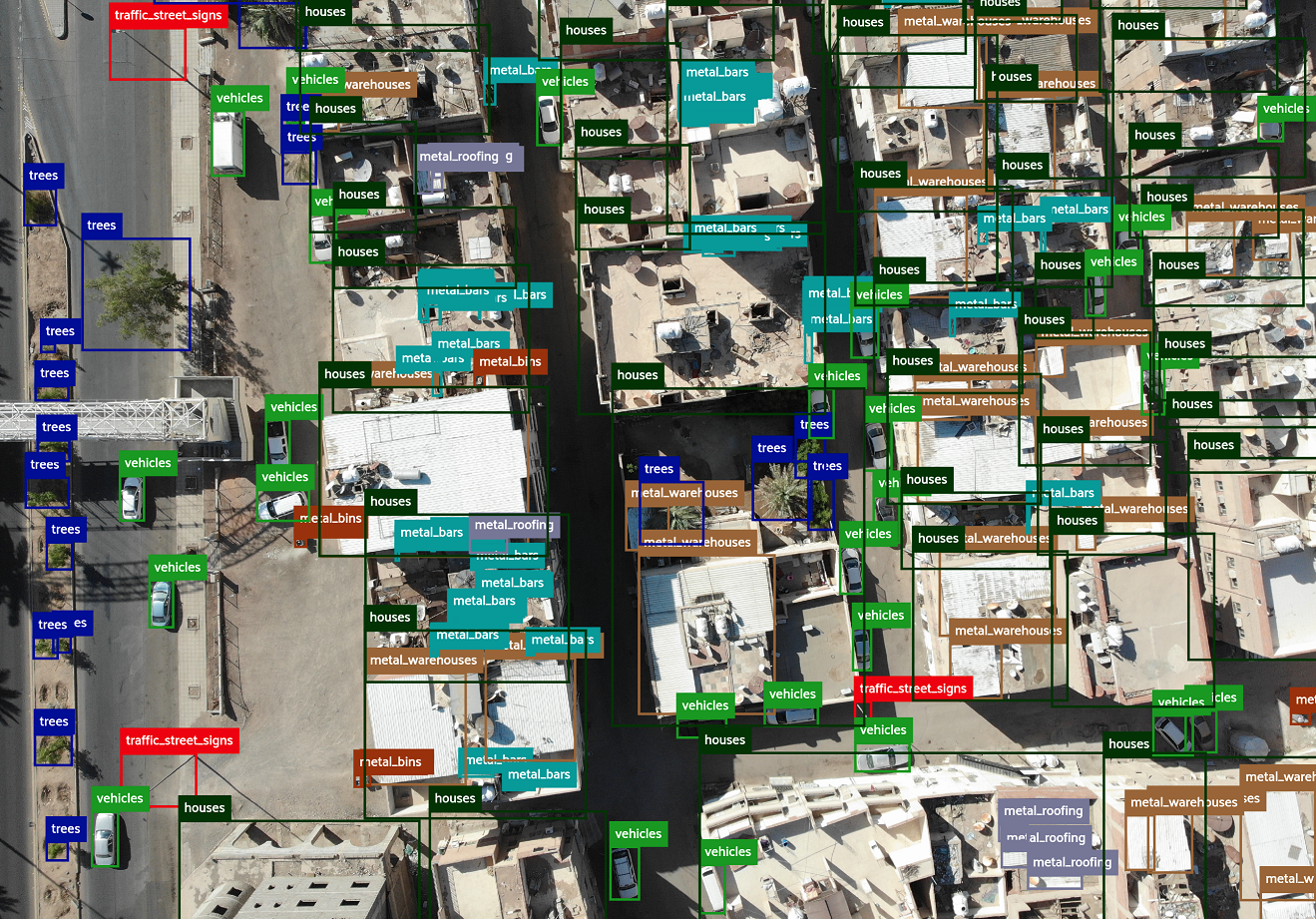
A software to automatically analyze drone and satellite images, extract insights and streamline them in a consumable and user-friendly form such as Geographic information system (GIS) or BI dashboard/report. Geospatial Analytics enables staff members to utilize multiple available analytical models, such as trash detection, construction debris, trees/plants, cars, houses, people, solar panels, swimming pools, and other.
It allows users to automate detection, recognition and counting of various objectы that typically require huge manual effort e.g. cars, boats, trees, people, etc. Employees can automate the inspection of the site for compliance, manage border control activities and detection of illegal intrusion, detect object and materials for inventory management, iden...
Geospatial Analytics Pricing
The product pricing depends on the usage and starts from 300 Euros per month. The main pricing drivers are: 1) Amount and type of AI model utilized 2) Amount of images to process 3) Access to interactive GIS dashboard 4) Access to photos stitching (orthophotomaps) 5) Access to additional functionality and features
Starting price:
€300.00 per month
Free trial:
Available
Free version:
Not Available
Be the first to review Geospatial Analytics
Share your thoughts with other users.