


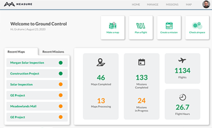
Measure Ground Control
About Measure Ground Control
Measure Ground Control Pricing
Measure Ground Control is available for free and across two pricing plans: PRO: $69/monthly (billed annually) or $99/monthly (billed monthly) ENTERPRISE: Please contact Measure Global directly for pricing details.
Starting price:
$99.00 per month
Free trial:
Available
Free version:
Available
Most Helpful Reviews for Measure Ground Control
1 - 5 of 40 Reviews
Jody
Photography, 2-10 employees
Used daily for less than 6 months
OVERALL RATING:
5
EASE OF USE
4
VALUE FOR MONEY
5
FUNCTIONALITY
5
Reviewed October 2020
Great so far...
Other than the LAANC thing everything else has been great. I've grown to trust this app is gonna fly my drone exactly as I planned ahead of time and then bring it back when done. I have my own processing setup already but the 2 free maps per month have actually come in handy as well (when I'm in a hurry I'll start the upload while still in the field and once my computer was down at the time). I have recommended this app to many of my friends/pilots and I will continue to do so. 2 thumbs up from me.
PROSI like how everything I need is all rolled into one software.
CONSMy only gripe to this point is while they advertise you can get LAANC authorization it's really just a link to Airmap. Kinda misleading as far as I'm concerned.
Reasons for switching to Measure Ground Control
I had experienced 2 flyaways in a row using drone deploy and completely lost trust in the app. Luckily I got my drone back both times but I didn't want to try it for a 3rd time lol.
Will
Utilities, 201-500 employees
OVERALL RATING:
4
EASE OF USE
5
VALUE FOR MONEY
4
FUNCTIONALITY
3
Reviewed September 2020
Trial for use in stockpile management
We were very interested and optimistic about using this tool for replacement of our traditional aerial surveys for coal and byproducts stockpile management. However, upon using it on a trial basis, we found that we could not get the output we needed to interface with our systems. We were disappointed that this was the case as all the other tools in Measure were so intuitive and well integrated.
PROSVery easy and intuitive to use. Great integration of flight planning and flight logs Powerful integration with PIX4D
CONSCannot output DXF files of triangulated surfaces Can't input DXF files of triangulated surfaces representing complex base surfaces of piles
Reason for choosing Measure Ground Control
Ultimately we chose Propeller Aero as it can easily use DXF files and the PPK option enabled very accurate surveys.
Anonymous
2-10 employees
OVERALL RATING:
1
EASE OF USE
4
VALUE FOR MONEY
2
CUSTOMER SUPPORT
2
FUNCTIONALITY
2
Reviewed October 2020
Whoops!
Complete Fail! I am a safe, skilled and experienced FAA certified drone pilot for films, television and commercials. My industry has very little work going on due to Covid. I was looking forward to working with a new company who hired me to fly. I told them I had never used Measure Ground Control before and they assured me that they would verify the mission they were asking me to upload comletely to make sure it would execute. I went to the location and did the first part of the job manually using my DJI App. It went well and looked great. When I called up the mission in the Ground Control App, I was looking forward to it automatically executing. It kept stopping at a certain point 1/8th into the mission. I later found out that it did not execute because you have to sign in to the DJI App on Measure Ground Control and sign in to Airmaps to get clearance around some Geofences that the company I was hired to fly for did not even know existed in the area. The company I was flying for somehow blamed me for this and has not hired me again even though they knew I never flown with Ground Control before and paid me because they acknowledged this issue. I flew the mission they needed manually to the best of my ability and got them as much of it that I could get (90%). Still they have not hired me again due to this issue in your App. I have used Litchi and Waypoints in DJI and other apps and never had this issue occur. Please correct this in your App!
PROSI like that the interface looked easy.
CONSNo one instructed me that you have to sign in to the DJI App on Measure Ground Control every single time and sign in to Airmaps in order to get clearance around some Geofences. The company I was flying for blamed me for this and has not hired me again since even though they knew I never flown with Ground Control before.
Reasons for switching to Measure Ground Control
I didn't want to make the switch. The company I was flying for uses Measure Ground Control and it was the worse experience using any app to fly my drone. The idea that the company "blamed" me for the App's shortfall and their own shortfall which they acknowledged was rather disturbing.
Chad
Oil & Energy, 1 employee
OVERALL RATING:
4
EASE OF USE
3
VALUE FOR MONEY
5
CUSTOMER SUPPORT
3
FUNCTIONALITY
4
Reviewed September 2020
Great Value! But Dashboard Needs Streamlining
I was excited to use a new A.I. platform for flight planning that had a reasonable price point for smaller, start-up drone companies like mine. Measure Ground Control offers many of the same features as other programs (easy geofencing, A.I. flight plans, multi-battery missions, .kml import...) but at a much more competitive price, and also allows a free version for those who may not need to use it as often (two free). I found the individual tools to be easy to use and plan with. The only thing I've found as a knock on Measure Ground control, and maybe it's just me, but initially it seems awkward moving between "missions," "maps," "flight plans" etc. I was having trouble trying to figure out the difference between "Mission" and "Flight Plan" and "Map" as they can all be somewhat construed the same thing in certain mapping situations. I'm still learning so perhaps it will become easier to distinguish. The only other issue I had was that I attempted to fly my first flight plan using my iPad rather than my iPhone. However, I guess my iPad would not allow the latest version of Measure's Ground Control app to download, but it did allow the install of an older version. I didn't think much of it until I launched and had literally no manual control over my drone. Hith the Home button, recovered, and launched again using the iPhone. Flight went GREAT! Took two batteries and resumed with battery two VERY easily. I was definitely impressed with the ease of the app during flight.
PROSPrice point, reliable A.I. flight planning, mosaic map clarity, and easy-to-understand front-facing app are all great features of Measure Ground Control.
CONSSeems intially awkward to navigate in the personal dashboard.
Reasons for switching to Measure Ground Control
Measure Ground Control is hitting the upstart and smaller company niche/market that was previously not being catered to. DroneDeploy, Pix4D and others are still just too expensive for upstart pilots who are only getting 2 - 6 jobs a month. If all your capital is going to the software platform fees, there's nothing left for profit or upgrading hardware. Measure Ground Control is affrodable enough that ever the small guys out there can jump on the drone wave and start learning how to map like the pros.
ED
Utilities, 2-10 employees
Used daily for more than 2 years
OVERALL RATING:
4
EASE OF USE
4
VALUE FOR MONEY
3
CUSTOMER SUPPORT
5
FUNCTIONALITY
3
Reviewed October 2020
ADS review
Started at $29/ month, now $99/$69 per month very expensive . Pix4D very limited use when compared To actual app.
PROSExcellent grid and w/p missions. Supported M210/ XT2 camera
CONSNot able to link new drone, Autel Evo 2 Pro by IOS or Android app
Reason for choosing Measure Ground Control
We own several drones needed thermal ability mapping/grid for M210RTK and XT2. Now we have other options. Unless MGC can support newly released Autel Evo 2 Pro soon will seek another software.


