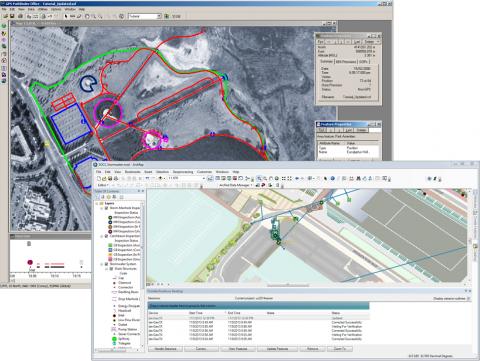
Trimble TerraSync
About Trimble TerraSync
Trimble TerraSync Pricing
Contact Trimble for pricing details.
Free trial:
Not Available
Free version:
Not Available

Other Top Recommended Facility Management Software
Most Helpful Reviews for Trimble TerraSync
1 - 5 of 12 Reviews
Hilary
Verified reviewer
Environmental Services, 201-500 employees
Used more than 2 years
OVERALL RATING:
5
EASE OF USE
3
CUSTOMER SUPPORT
5
FUNCTIONALITY
4
Reviewed September 2018
For environmental professionals, TerraSync is a great thing!
Overall, I have been pleased with TerraSync and the services it provides. Anything that streamlines field work is greatly appreciated, and this software does just that.
PROSTerraSync is great for the transfer of data between the GPS unit and your computer. The software makes going into the field easy - from quick upload of pre-selected sample locations to fast download of collected data points post-effort.
CONSThe software does seem to have a few quirks - I've had coordinate system units change from feet to meters on me a few times between upload and transfer to the GPS unit, which can be tricky when trying to fix real-time in the field.
Anonymous
1,001-5,000 employees
Used weekly for more than 2 years
OVERALL RATING:
4
EASE OF USE
3
FUNCTIONALITY
4
Reviewed March 2021
Standard, but showing its age
It's worked for me for the past 11 years since I started out in the field, and continues to work. Having worked with other software, particularly more GIS-based applications for mobile devices, it just seems clunky and like it's not advancing at the same rate.
PROSThis is the tried and true software for Trimble GPS units. It's easy enough to use, and lets me collect my data.
CONSI really find the lack of interaction with background files annoying. If you want a background layer (roads, for example), but you want to be able to see any associated information, you have to put that background layer into a data file, match it with your data dictionary, etc..., then upload. If you're standing at your tailgate with a laptop and somebody has just emailed you a shape, you don't want to mess with that. You just want to load it and go.
Nathan
Verified reviewer
Civil Engineering, 51-200 employees
Used daily for more than 2 years
OVERALL RATING:
3
EASE OF USE
1
VALUE FOR MONEY
1
CUSTOMER SUPPORT
2
FUNCTIONALITY
4
Reviewed February 2018
It feels like it's software that is stuck in the 90s - but it does everything it needs to.
It's literally the only software/hardware combo that can do what we need to do in a way that doesn't require backpack units and huge capital investments. It's amazingly powerful but implemented in a really dumb way.
PROSThe functionality is pretty amazing - the ability to geolocate with that level of precision, to do these corrections that rapidly, to do it in the field with a laptop is insane. That being said, the actual handheld user experience on a GEOXT or whatever is mediocre at best. I mean, we use it every day for projects that we couldn't otherwise do - but only because it's the only option, not the best.
CONSThe user interface makes no sense, the terminology of 'background' vs 'data' files is silly and non-intuitive, using it to navigate in the field is hit-and-miss (I'd rather have a topo and a compass), and editing features is almost impossible.
Alaila
Verified reviewer
Used less than 2 years
OVERALL RATING:
5
EASE OF USE
4
VALUE FOR MONEY
4
CUSTOMER SUPPORT
4
FUNCTIONALITY
5
Reviewed June 2018
Trimble equipment is very useful for gravimetric surveys, seismic and topographic studies.
The software that terraSync are essential tools for a field geolocation work, allowing the field operator to store all the data collected in a single computer that can later be downloaded to a computer in the easiest and most efficient way. They are high precision equipment for seismic surveys, georadar, topographic surveys, etc.
CONSTrimble functional equipment perfectly in open areas free of vegetation which is a limitation for spaces with high density of vegetation, losing signal capture data.
Anonymous
1,001-5,000 employees
Used weekly for less than 2 years
OVERALL RATING:
5
EASE OF USE
5
CUSTOMER SUPPORT
5
FUNCTIONALITY
5
Reviewed October 2020
Trimble Terasync
Trimble is a leading GPS product. The onboard interface used on their systems is easy to navigate.
CONSMay take some time to get used to all the buttons and features, but overall great experince.


