

IGiS Enterprise Suite
Overview
About IGiS Enterprise Suite
IGiS Enterprise Suite is a scalable geographic information system (GIS) solution designed to securely share geospatial data over the Internet and intranet. It can be used by organizations across various industries including agriculture, utilities, urban planning, forestry, and others.
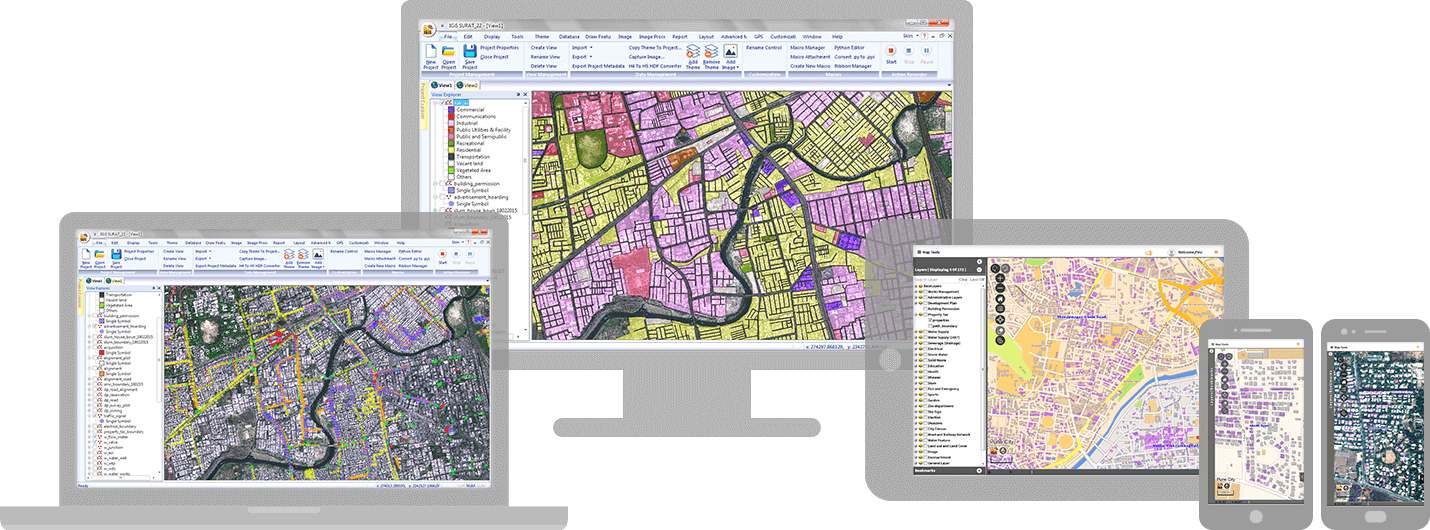
To support end-to-end enterprise geospatial solutions, IGiS Enterprise Suite offers robust capabilities and functionality. Its key components include Desktop, Server, Publisher, Web, Mobile, Widget, CAD, and SDK, plus access to various OGC compliance services. The suite offers tools for 2D and 3D geospatial analysis, mapping, and visualization.
Support for IGiS Enterprise Suite is provided by Scanpoint Geomatics via an online knowledge base and support desk.
IGiS Enterprise Suite Pricing
Free trial:
Not Available
Free version:
Not Available
Most Helpful Reviews for IGiS Enterprise Suite
1 Review
Anonymous
201-500 employees
Used weekly for less than 2 years
Review Source: Capterra
This review was submitted organically. No incentive was offered
OVERALL RATING:
5
EASE OF USE
5
VALUE FOR MONEY
4
FUNCTIONALITY
5
Reviewed November 2023
Best GIS Enterprise Suite
IGiS Enterprise is the combination of GIS and image processing capabilities. This software is jointly developed by ISRO and SGL. I am using IGiS Desktop and photogrametery as well and utinilising this enterprise suite to share, manage, and distribute data with IGiS Server.
PROSISRO is the product development partner for IGiS, It's the most trusted name in the industry. Also, IGiS Enterprise Suite is the only GIS software with Integrated GIS and Image Processing Capability.
CONSI am using this software from last 2+ years nothing I dislike.