


Pandell GIS
No reviews yet
Overview
About Pandell GIS
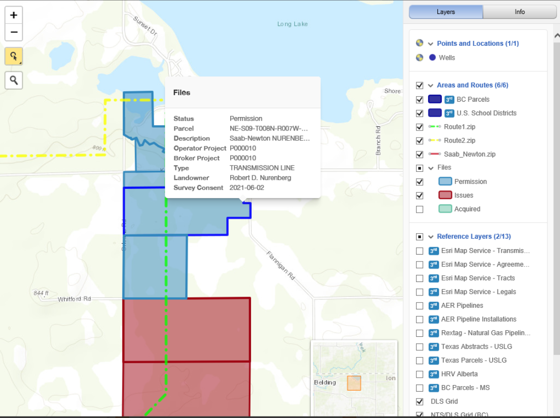
Pandell GIS is a land mapping software that helps businesses create and maintain spatial data for various projects including utilities, upstream and midstream oil and gas and renewables. The platform enables managers to capture and record agreement details and track the status of land rights on a unified interface.
Key features include auto-mapper, parcel tools, master tract loader, GIS analyzer, lease dissection, GIS-enabled dashboards and live project status maps. Additionally, Pandell GIS lets stakeholders integrate the system with several applications including Pandell LandWorks and ArcGIS.
Pandell GIS Pricing
Contact Pandell for pricing details.
Starting price:
$0.01
Free trial:
Not Available
Free version:
Not Available
Be the first to review Pandell GIS
Share your thoughts with other users.